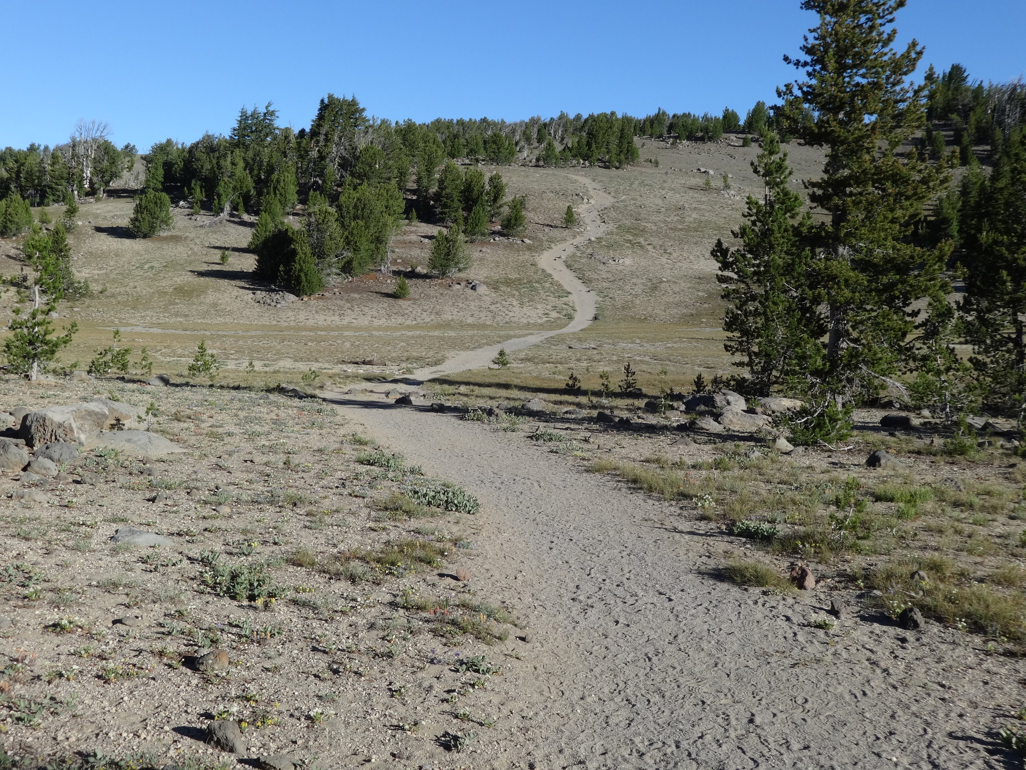
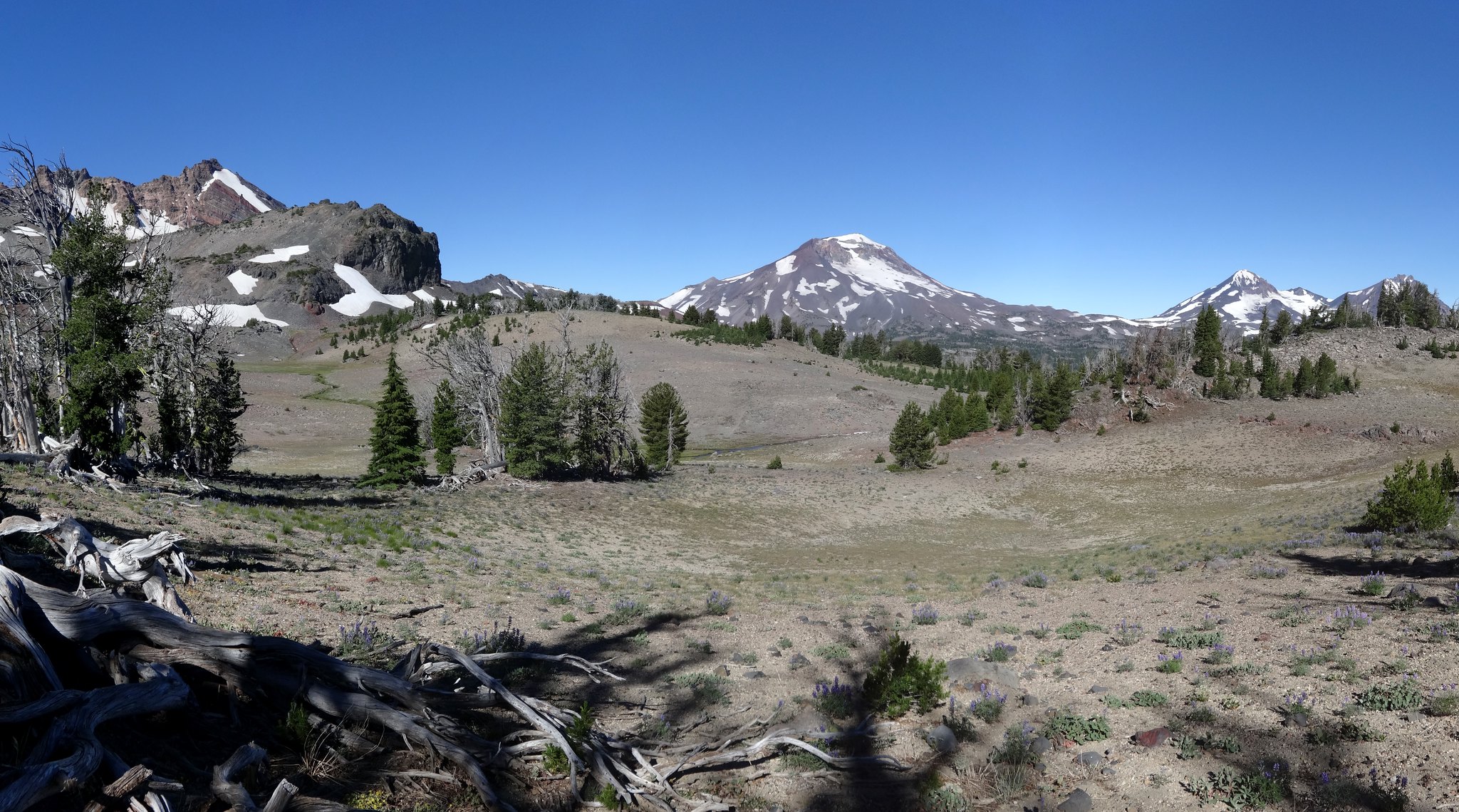
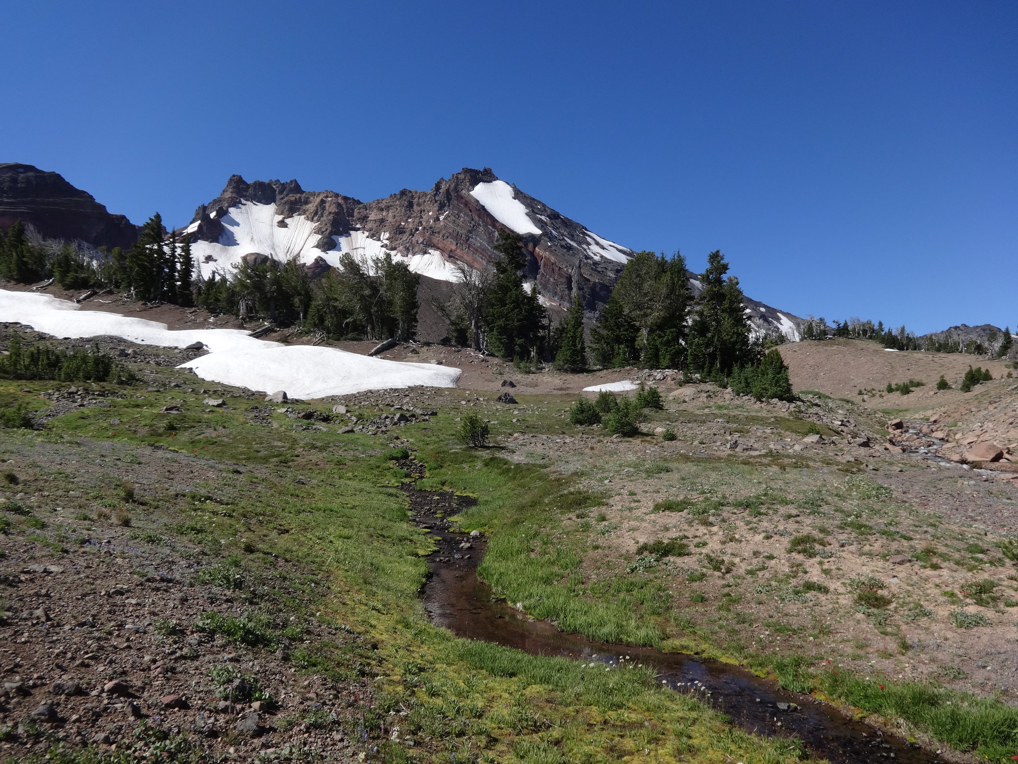
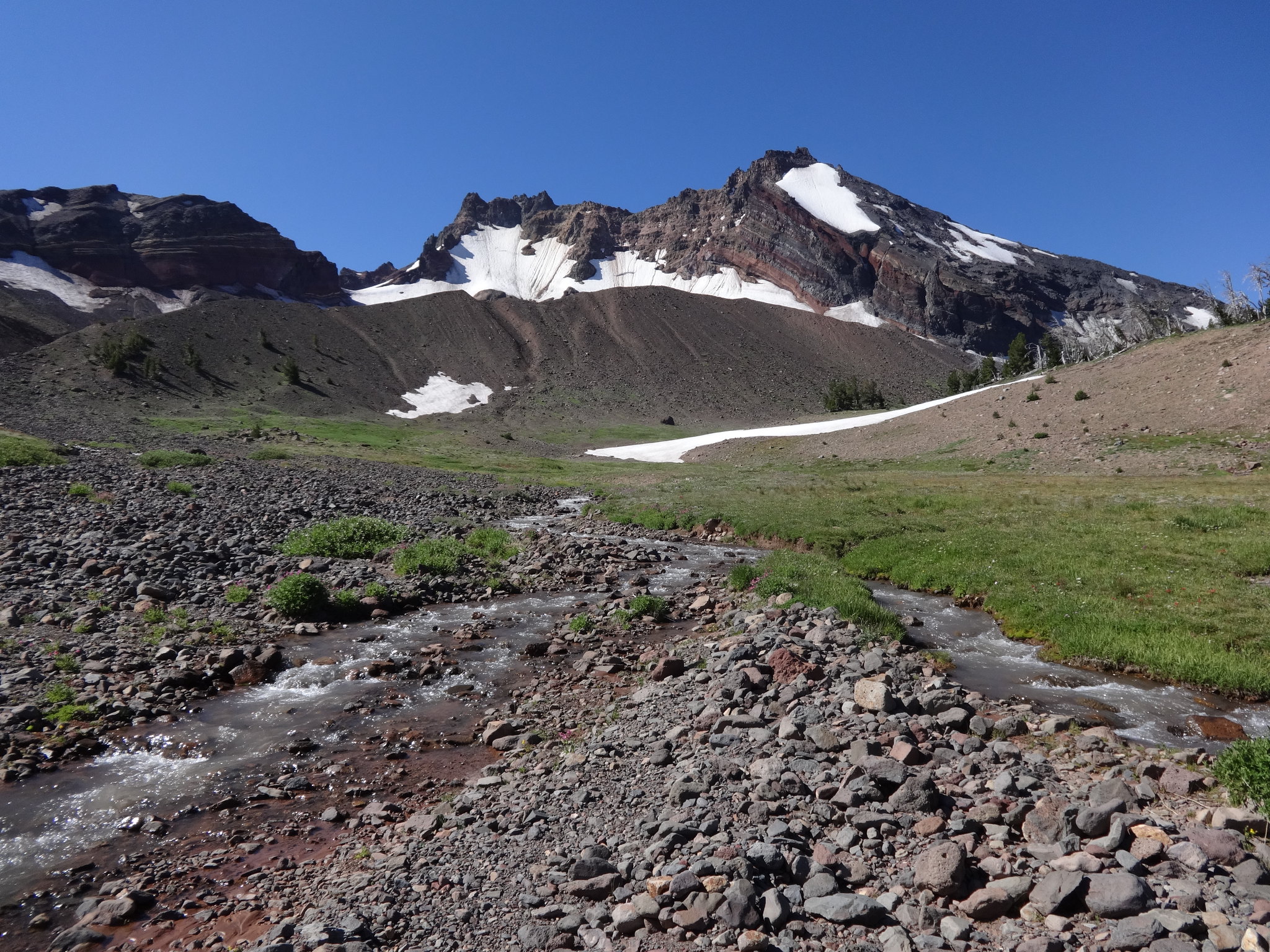
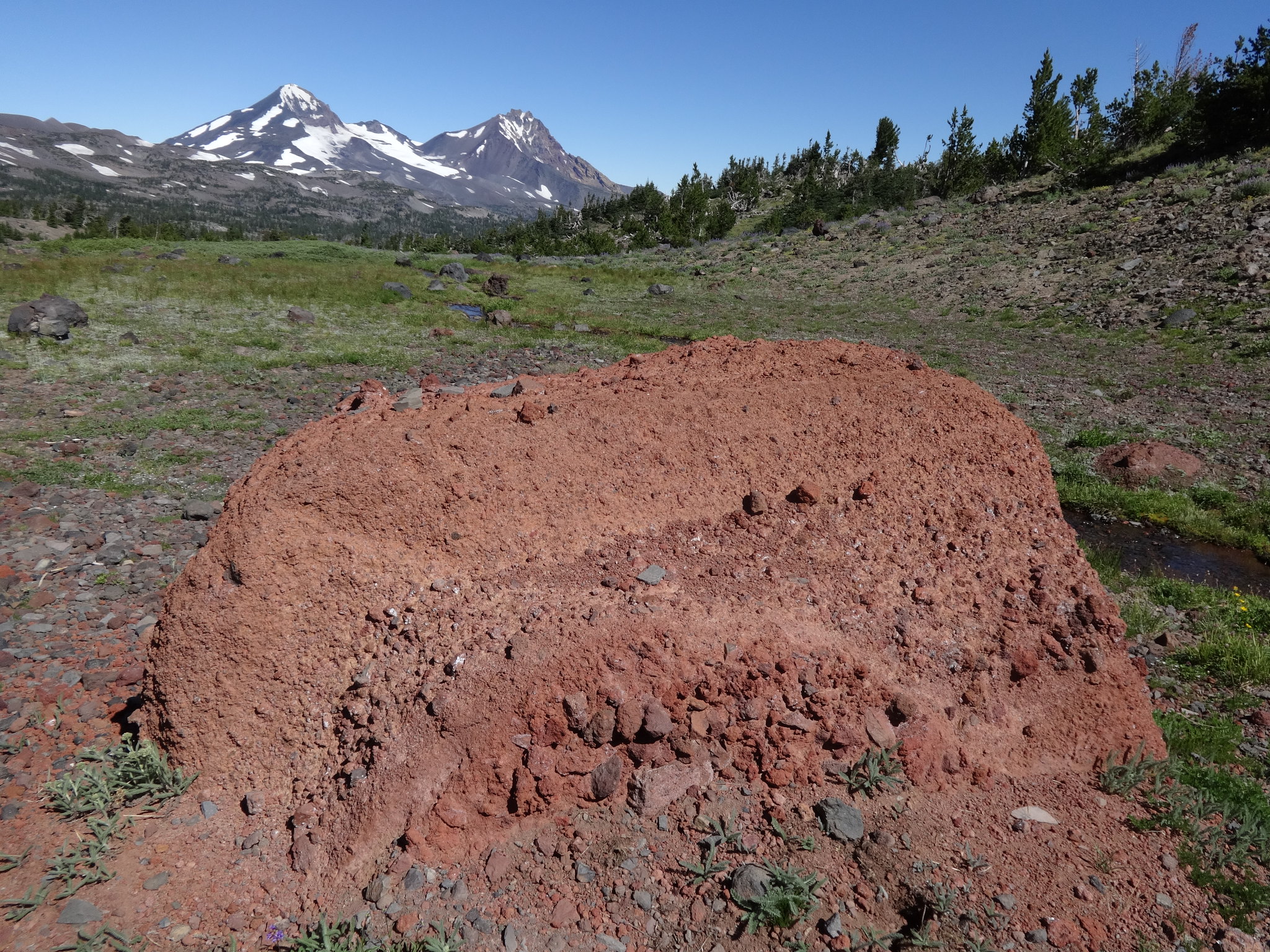
Spring Basin Super Loop: 3/18/26: https://www.oregonhikers.org/forum/viewtopic.php?f=8&t=32840
Wallowas Cornucopia Loop: 8/25/25-8/26/25: https://www.oregonhikers.org/forum/viewtopic.php?f=8&t=32303
Idaho Snake River Trail: 4/15/25-4/17/25: https://www.oregonhikers.org/forum/viewtopic.php?f=8&t=32005
Criterion Tract Loop: 3/25/25: https://www.oregonhikers.org/forum/viewtopic.php?f=8&t=31958
Table/Cedar/Aldrich: 9/15/24: https://www.oregonhikers.org/forum/viewtopic.php?f=8&t=31666
Cusick Mt. Success: 8/18/24 & 8/30/24: https://www.oregonhikers.org/forum/viewtopic.php?f=8&t=31660
Wallowas: Tram/Sheep/Bonny 7/3/24-7/4/24: https://www.oregonhikers.org/forum/viewtopic.php?f=8&t=31490
N Fk Middle Fk Imnaha: 9/8/23-9/9/23: https://www.oregonhikers.org/forum/viewtopic.php?f=8&t=31081
SE Wallowas/Boner Flat: 8/26/23-8/27/23: https://www.oregonhikers.org/forum/viewtopic.php?f=8&t=30992
Enchantments Thru-Hike - 7/26/23: https://www.oregonhikers.org/forum/viewtopic.php?f=8&t=30934
Hells Canyon After The Fire: 6/14/23-6/15/23: https://www.oregonhikers.org/forum/viewtopic.php?f=8&t=30847
Mt. Adams, Sunrise Camp: 9/25/22: https://www.oregonhikers.org/forum/viewtopic.php?f=8&t=30561
Mt Adams 360: 9/2/22-9/4/22: https://www.oregonhikers.org/forum/viewtopic.php?f=8&t=30517
Wallowas, South Wallowas: 8/24/22: https://www.oregonhikers.org/forum/viewtopic.php?f=8&t=30500
HCNRA, Haas Ridge: 7/1/22: https://www.oregonhikers.org/forum/viewtopic.php?f=8&t=30399&p=223560#p223560
HCNRA, Noth WRNRT/Cow Creek Loop: 6/1/22-6/2/22:
HCNRA, Hells Canyon: 5/10/22-5/11/22: https://www.oregonhikers.org/forum/viewtopic.php?f=8&t=30303&p=222948#p222948
Doug’s Beach/Lyle CO/DNR: 2/9/22: https://www.oregonhikers.org/forum/viewtopic.php?f=8&t=30182&p=222109#p222109
Criterion Tract South: 2/3/22: https://www.oregonhikers.org/forum/viewtopic.php?f=8&t=30174&p=222061#p222061
Criterion Tract North: 1/21/22: https://www.oregonhikers.org/forum/viewtopic.php?f=8&t=30160&p=221965#p221965
Wallowas, Ridge Walking: 7/7/21-7/9/21: https://www.oregonhikers.org/forum/viewtopic.php?f=8&t=29841&p=219688#p219688
HCNRA, Morgan/Summit/Freezeout Loop: 6/4/21: https://www.oregonhikers.org/forum/viewtopic.php?f=8&t=29732&p=219004#p219004
HCNRA, Eureka Wagon Road/Cemetery Ridge Loop: 5/28/21: https://www.oregonhikers.org/forum/viewtopic.php?f=8&t=29699&p=218797#p218797
HCNRA, Idaho Snake River Trail: 4/15/21-4/17/21: https://www.oregonhikers.org/forum/viewtopic.php?f=8&t=29628&p=218234#p218234
Wonderland Trail: 7/30/20-8/3/20: https://www.oregonhikers.org/forum/viewtopic.php?f=8&t=29410&p=216581#p216581
HCNRA, Lord Flat/Somers Point: 7/8/20-7/9/20: https://www.oregonhikers.org/forum/viewtopic.php?f=8&t=29057&p=214393#p214393
MH, Mississippi Head Loop: 6/19/20: https://www.oregonhikers.org/forum/viewtopic.php?f=8&t=28969&p=213908#p213908
Wallowas, Hurwal Divide Traverse: 8/22/19-8/23/19: https://www.oregonhikers.org/forum/viewtopic.php?f=8&t=28485&p=210475#p210475
Wallowas, Super Loop: 8/1/19-8/2/19: https://www.oregonhikers.org/forum/viewtopic.php?f=8&t=28406&p=209921#p209921
Mt Hood 360: 6/28/19-6/29/19: https://www.oregonhikers.org/forum/viewtopic.php?f=8&t=28311&p=209323#p209323
Mt Hood 360: 6/27/18-6/29/18: https://www.oregonhikers.org/forum/viewtopic.php?f=8&t=26834&p=202814#p202814
Wallowas, Peak-A-Boo: 8/12/17: https://www.oregonhikers.org/forum/viewtopic.php?f=8&t=25888&p=196096#p196096
Wallowas, Sac/Matt/Cap w/VM: 7/21/16-7/23/16: https://www.oregonhikers.org/forum/viewtopic.php?f=8&t=24345&p=184699#p184699
CCSP, Cottonwood Canyon Figure 8: 3/19/16: https://www.oregonhikers.org/forum/viewtopic.php?f=8&t=23487&p=178845#p178845
MSH, JRO to The Dome: 9/13/15: https://www.oregonhikers.org/forum/viewtopic.php?f=8&t=22634&p=172076#p172076
MJW, The Table/Forked Butte: 6/19/15-6/20/15: https://www.oregonhikers.org/forum/viewtopic.php?f=8&t=21978&p=166969#p166969
HCNRA, Hells Canyon Rim: 6/5/15-6/7/15: https://www.oregonhikers.org/forum/viewtopic.php?f=8&t=21905&p=166378#p166378
Red Trinity Alps: 5/22/15-5/24/15: https://www.oregonhikers.org/forum/viewtopic.php?f=8&t=21775&p=165067#p165067
MSH, Coldwater Peak from JRO: 5/9/15: https://www.oregonhikers.org/forum/viewtopic.php?f=8&t=21656&p=164007#p164007
MSH, Mt. Margaret Backcountry Super-loop: 10/4/14: https://www.oregonhikers.org/forum/viewtopic.php?f=8&t=20214&p=150465#p150465
McGregor Mt. Loop: 9/11/14-9/14/14: https://www.oregonhikers.org/forum/viewtopic.php?f=8&t=20073&p=148999#p148999
Upper Enchantments Basin Day Hike: 8/18/14: https://www.oregonhikers.org/forum/viewtopic.php?f=8&t=19851&p=147111#p147111
Devils Garden/Avalanche Valley on Mt. Adams: 8/7/14-8/9/14: https://www.oregonhikers.org/forum/viewtopic.php?f=8&t=19736&p=145956#p145956
Wallowas, Making Passes in the Wallowas: 7/18/14-7/19/14: https://www.oregonhikers.org/forum/viewtopic.php?f=8&t=19562&p=144541#p144541
HCNRA, Hells Canyon Loop: 6/19/14-6/22/14: https://www.oregonhikers.org/forum/viewtopic.php?f=8&t=19263&p=142202#p142202
HCNRA, Hells Canyon-Hat Point/Bear Sighting w/pic: 6/5/14-6/6/14: https://www.oregonhikers.org/forum/viewtopic.php?f=8&t=19133&p=141260#p141260
Metolius River Backpack Trip: 5/1/14-5/3/14: https://www.oregonhikers.org/forum/viewtopic.php?f=8&t=18798&p=138881#p138881
Lost Coast: 4/17/14-4/19/14: https://www.oregonhikers.org/forum/viewtopic.php?f=8&t=18686&p=138090#p138090
Tomlike/Benson Loop: 4/8/14: https://www.oregonhikers.org/forum/viewtopic.php?f=8&t=18554&p=137152#p137152
School Canyon/Little Badger Creek Loop: 3/16/14: https://www.oregonhikers.org/forum/viewtopic.php?f=8&t=18385&p=135655#p135655
Observation Peak Loop: 12/24/13: https://www.oregonhikers.org/forum/viewtopic.php?f=8&t=17760&p=130339#p130339
Hardy Ridge via Kueffler Road: 11/17/13: https://www.oregonhikers.org/forum/viewtopic.php?f=8&t=17524&p=128232#p128232
Mt. Hood 360F: 9/12/13-9/13/13: https://www.oregonhikers.org/forum/viewtopic.php?f=8&t=17025&p=124073#p124073
Mt. Adams360: 8/23/13-8/25/13: https://www.oregonhikers.org/forum/viewtopic.php?f=8&t=16833&p=122637#p122637
Mt. Jeff Wilderness/Table Lake Area: 8/2/13-8/3/13: https://www.oregonhikers.org/forum/viewtopic.php?f=8&t=16562&p=120676#p120676
Wallowas, Eagle Cap Greatest Hits: 7/18/13-7/20/13: https://www.oregonhikers.org/forum/viewtopic.php?f=8&t=16304&p=118988#p118988
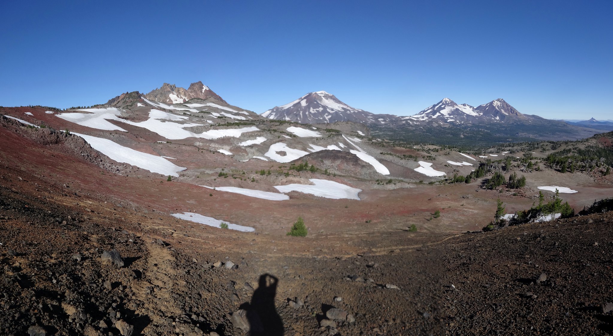
Broken Top 360: 7/12/13-7/13/13: https://www.oregonhikers.org/forum/viewtopic.php?f=8&t=16187&p=118041#p118041
Waldo Lake Circumnavigation: 6/28/13-6/29/13: https://www.oregonhikers.org/forum/viewtopic.php?f=8&t=15933&p=116599#p116599
N. Fk. John Day Wldrnss Backpack: 6/20/13-6/23/13: https://www.oregonhikers.org/forum/viewtopic.php?f=8&t=15844&p=115992#p115992
Wenaha-Tucannon Backpack: 4/25/13-4/27/13: https://www.oregonhikers.org/forum/viewtopic.php?f=8&t=15134&p=109779#p109779
Lyle Cherry Orchard Exploration: 2/9/13: https://www.oregonhikers.org/forum/viewtopic.php?f=8&t=14560&p=104575#p104575
Mississippi Head/Illumination Rock/B-26 Wreckage: 10/6/12: https://www.oregonhikers.org/forum/viewtopic.php?f=8&t=13504&p=95441#p95441
Enchantments/Stuart Lake/Mountain Goats: 8/20/12-8/22/12: https://www.oregonhikers.org/forum/viewtopic.php?f=8&t=12982&p=91140#p91140
Table Lake Loop/Mt. Jeff Wilderness/Bushes From Hell: 8/1/12: https://www.oregonhikers.org/forum/viewtopic.php?f=8&t=12773&p=89481#p89481
Backpacking Irish Mt/Mink Lake Loop – 7/20/12-7/22/12: https://www.oregonhikers.org/forum/viewtopic.php?f=8&t=12575&p=88137#p88137
HCNRA, Backpacking Hells Canyon NRA – 6/20/12-6/22/12: https://www.oregonhikers.org/forum/viewtopic.php?f=8&t=12151&p=85208#p85208
Backpacking the Rogue River – 6/9/12-6/12/12: https://www.oregonhikers.org/forum/viewtopic.php?f=8&t=12024&p=84227#p84227
Backpacking the CA Lost Coast - 5/10-5/13: https://www.oregonhikers.org/forum/viewtopic.php?f=8&t=11624&p=81391#p81391
Swale Creek - 3/17/12: https://www.oregonhikers.org/forum/viewtopic.php?f=8&t=11100&p=77585#p77585
Silver Star Super Loony Loop - 12/17/11: https://www.oregonhikers.org/forum/viewtopic.php?f=8&t=10311&p=70148#p70148
Hiking With The Loonies/Siouxon Area - 11/12/11: https://www.oregonhikers.org/forum/viewtopic.php?f=8&t=10018&p=67360#p67360
Barrett Spur/Dollar Lake Fire Damage - 10/16/11: https://www.oregonhikers.org/forum/viewtopic.php?f=8&t=9776&p=64737#p64737
East/West Zigzag Loop - 10/8/11: https://www.oregonhikers.org/forum/viewtopic.php?f=8&t=9723&p=64223#p64223
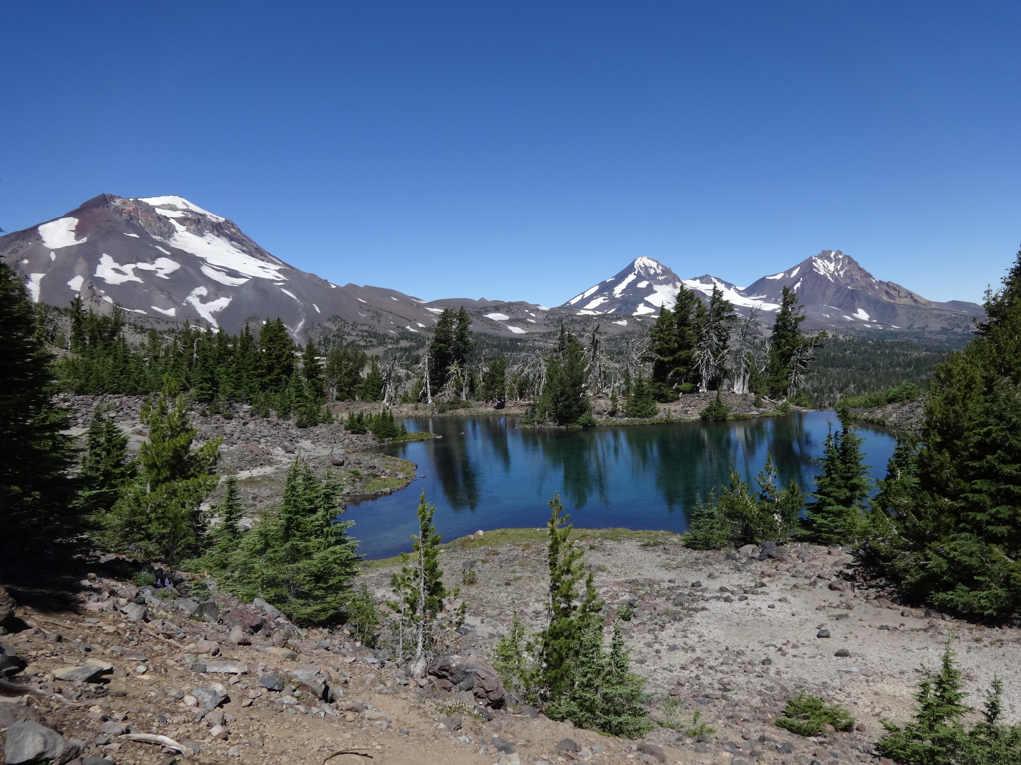
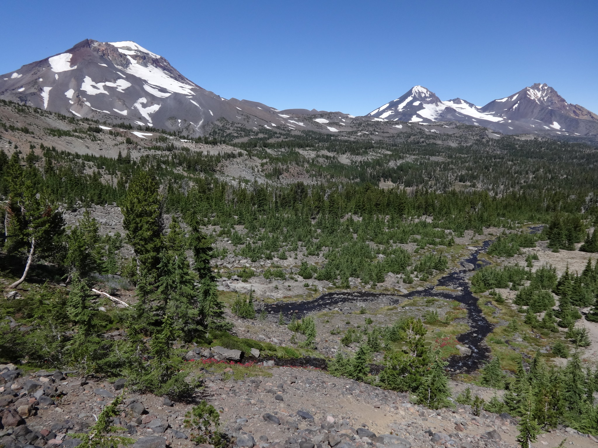
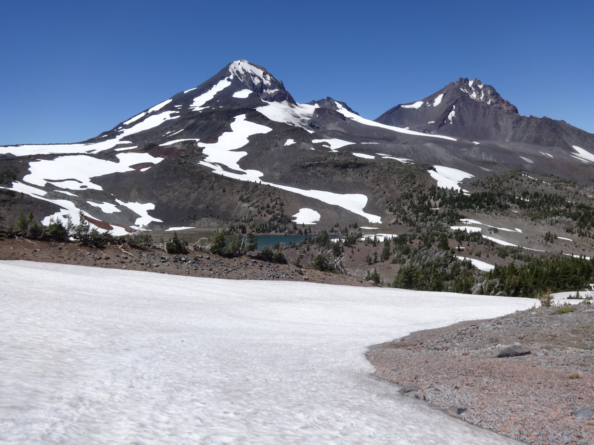
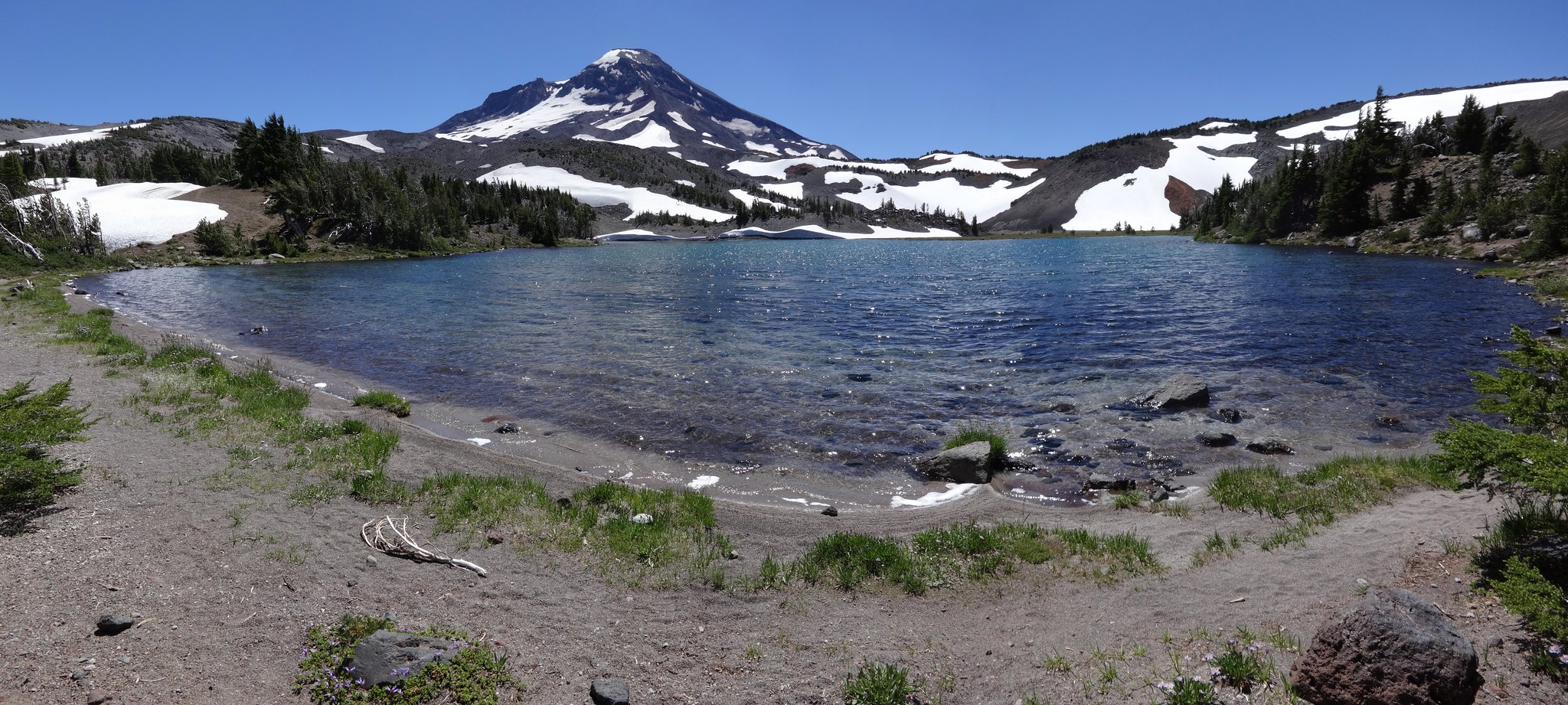
Three Sisters Loop - 9/3-9/5: https://www.oregonhikers.org/forum/viewtopic.php?f=8&t=9395&p=61399#p61399